Shane rolled his eyes, out of sight of Kendall, before turning around. “I’m on it, boss man. It’ll be done by tomorrow,” he said, walking past him.
“Good man,” the team sergeant replied as he slapped Price on the back and headed out of the tent and on toward the unenviable task of inventorying all of the team’s equipment by serial number. For every opportunity a Special Forces Engineer Sergeant had to set off explosives, there were ten inventories that needed to be conducted. Kendall nodded at Wilde with a wink and then continued on to engage in conversation with Deforest.
“Right, then,” Wally said. “I’m going to hit the mess and grab some scran. I’ll catch up with you gents later.” He turned to Ahmed and gave him a mock salute.
Ahmed returned the sentiment before turning his attention back to Wilde. “So, we noticed something interesting from the satellite photos of the attack.”
Wilde was immediately interested. The two sides often shared information such as imagery with each other, although the Saudis didn’t always offer it up freely, making him doubly curious. Of course the imagery came from U.S. satellites, but what the Saudi analysis may have discovered was something entirely different.
“What do you mean?” They had switched back to Arabic.
Ahmed waved him over to one of the JOC’s laptops. He flipped through multiple satellite images until he located the correct one. They were stills that were given to the Saudis by the U.S. forces. After scrollingand finding the one he was searching for, Ahmed stopped and zoomed in. “This is where the attack happened.”
“Alright,” Wilde said, waiting patiently for the Saudi officer to reveal the relevant information.
Ahmed zoomed out. “You see the lines here?” He was motioning with the cursor along several dark impressions that ran away from a two-lane road to the northeast. Wilde nodded his affirmation and Ahmed continued. “These are routes the terrorists use to transit the desert. They move between camps, wells, towns, and roads.”
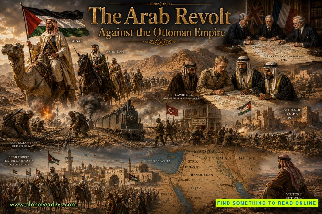
Wilde’s interest was piqued. He knew that Al Qaeda moved freely throughout the desert, avoiding major roads and population centers. In truth, he was envious of their tactics. During World War I the famous British officer T. E. Lawrence had used similar guerrilla tactics with the Arab partners he advised, striking at the Ottomans where they were vulnerable before melting back into the vastness of the desert. It was an effective way to conduct war in terrain such as the desert or the jungle. Controlling powers tended to occupy cities and forts, while the empty land in between was left largely permissible. If a small force utilized guerrilla tactics effectively, they could trap the larger force in their cities and have free rein of most of the country.
“Where do they lead?” Wilde asked, referring to the trails.
Ahmed nodded enthusiastically at the question as he switched to a different panel. It was a map of Yemen represented by a kaleidoscope of different colors. Wilde recognized it as LIDAR imagery from a satellite, or Light Detection and Ranging. It picked up data unrecognizable to the naked eye by measuring the exact distance of objects on the earth’s surface and registering precise geospatial measurements.
“It is a type of picture…” Ahmed began, trying to explain in terms Wilde would understand.
“Na’am, Ahmed,” Wilde said, cutting him off. “I know it.”
He peered intently at the screen. It was imagery provided from a U.S. MASINT, or Measurement and Signature Intelligence, satellite. It used a variety of sensors to reveal information that was otherwise imperceptible, and the lines were much more defined against the yellow and red backgrounds. He motioned toward the mouse. “May I drive?”
Ahmed looked confused at the colloquialism, then it dawned on him. He chuckled at the phrase and moved out of the seat, allowing Wilde to slip in. Taking control, the Special Forces Intelligence Sergeant zoomed in and out and scrolled in different directions along the lines, analyzing the routes as he worked. They ran to the southwest toward Sana’a, and the northeast toward Oman, with intersecting trails breaking off to the north. Continuing to follow the ones to the north, he noticed that they crossed into Saudi Arabia.
“Ahmed, what are these trails?”
“Darab al jamel.” Camel trails.
Wilde was perplexed. “Is there that much camel traffic?” They had not picked up on such activity through the use of ISR, or intelligence, surveillance, and reconnaissance drones.
Ahmed laughed again. “No, my friend. Ancient. Very ancient. Thousands of years.”
Wilde mulled that over. If the terrorists moved along these trails, perhaps the ODA could use them to track their movements and locate their camps. He wondered how long Ahmed had known about this and whether he had neglected to share the information at the behest of his government, or whether he had failed to recognize the significance of it all. It was likely that the truth was somewhere in the middle, but it was best to move on, maintain rapport, and get the most out of the new data. Working with a partner force always had its challenges, and intelligence sharing was usually one of them.
Wilde called Deforest over and explained what they were looking at. The team leader stared at the images for a long while before slowly nodding. “This is great information,” he said. “Could certainly be a game changer.”
Deforest promised to include it in the daily situation report, or SITREP, and request ISR birds to recon the trails. First, however, he needed Wilde to outline the trails in a KMZ file for use in Google Earth and send him the finished product, then type it up in an intelligence information report, or IIR.So much for the gym, Wilde thought. McBride was going to give him hell tomorrow.

As Deforest left to settle into his workstation, Wilde continued exploring the trails on the screen. They ran deep into Saudi Arabia, and he wondered if the Saudis monitored these trails for illegal crossings, either smugglers or terrorists. Up near the northern border of Yemen and extending into Saudi Arabia was the Rub’ al Khali, or Empty Quarter. It was characterized by a lack of water and a lack of civilization. Simplyendless leagues of sand. The trails continued north to a point where they seemed to curve unnaturally to the west and then converged with several other, fainter trails coming from multiple directions. The main route then carried on north toward Riyadh, the Saudi capital.
“Ahmed.” He called the Saudi officer back over, who had wandered away in search of a cup of tea. When Ahmed returned, Wilde asked, “What is this here?” He pointed at the convergence of the camel trails. “I don’t see a city on imagery.” He flipped back and forth between LIDAR and the satellite imagery. “Could this be a camp?”
“No, my friend,” Ahmed replied, stirring several packets of sugar into his black tea. “Ubar.”
“Ubar?” Wilde tried to recall the meaning. It took a few seconds before his mind switched gears from tactical operations to historical context and grasped onto the relevant information. “You mean the lost city of Ubar? Iram of the Pillars?” he asked incredulously.
“Na’am,” Ahmed confirmed nonchalantly. “The same.”
Wilde stopped and turned around fully in his chair to see if Ahmed was pulling his leg. He appeared very serious. “What makes you say that?”
“Everyone knows. This is where the lost city is.”